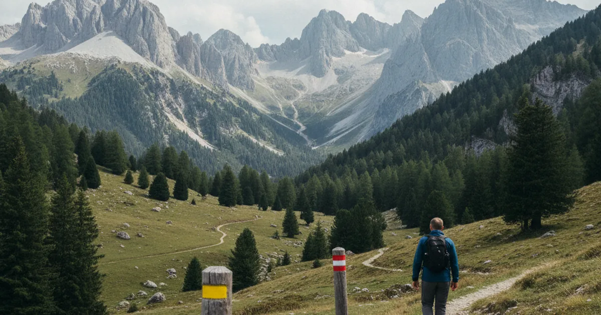
Head out on any hiking trail in Haute-Savoie and you'll quickly notice painted marks on rocks, trees and wooden posts. Yellow, red and white, red and yellow. These colours follow a precise code maintained by the FFRP (Fédération Française de Randonnée Pédestre, France's national hiking federation). Learning to read them before you set off will save you wrong turns and real frustration on the mountain.
Yellow marks: PR trails and local paths
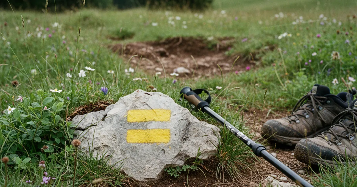
Yellow is the most common waymark you'll encounter on shorter day walks, family-friendly circuits and local discovery routes. It covers two categories: PR trails (Promenades et Randonnées) codified by the FFRP, and paths waymarked independently by municipalities, tourist offices and regional nature parks.
Reading a yellow mark is straightforward. A solid yellow rectangle means you're going the right way. Two bands crossed in an X mean wrong direction. An angle or arrow means a turn is coming.
Across the Aravis range and the Bauges massif, yellow marks dominate on day-trip circuits, regularly refreshed by local FFRP volunteers. On most outings in Haute-Savoie, yellow will be the colour you follow for the vast majority of the route.
Red and white: GR long-distance trails
Two horizontal bands stacked together, red and white: this is the mark of the GR trails (Grandes Randonnées, or Long-Distance Footpaths). These routes cross France over hundreds or even thousands of kilometres and are maintained to a consistent national standard under direct FFRP oversight.
In Haute-Savoie, the GR5 is the most iconic. It runs from the North Sea to the Mediterranean coast through the Alps, and you'll cross it on several massifs across the region. Once you know the red-and-white code, you'll spot it instantly.
The reading system is the same across all FFRP colours:
- Full mark: right direction, keep going.
- Mark crossed with a diagonal stroke: wrong way, turn back.
- Two bands forming an angle: turn here.
Red and yellow: GRP regional loop trails
Less well known than the red-and-white GR marks, the red-and-yellow waymarks identify GRP trails (Grandes Randonnées de Pays, or Regional Long-Distance Loops). These routes circle a massif, valley or region over several days, typically ending back at the starting point.
When you see two stacked bands in red and yellow, you're on a GRP. These trails are built around multi-day itineraries with overnight stops at mountain refuges, hikers' hostels or guesthouses, and they tend to wind through hamlets, summer pastures and lesser-used cols.
In the Annecy-Bauges area, several GRP routes let you traverse ridges and high pastures over multiple days without ever retracing your steps. A great format for walkers who want depth rather than just distance.
Reading waymarks with confidence
Whatever the colour, FFRP waymarks always use the same three signals:
- Solid mark: you're on track, carry on.
- X or crossed mark: wrong way, head back.
- Angle or arrow: a direction change is coming, pay attention.
Marks are placed at regular intervals along the route, more frequently at confusing junctions, in dense forest sections and on limestone pavement. Above the treeline, they're often supplemented by cairns (stacked stones) or painted metal poles to guide you across ridges and rocky gullies where no clear path exists.
One golden rule: if you haven't seen a waymark in more than five minutes of walking, stop. Go back to the last clear mark and re-orient from there. Never push forward blind on terrain you don't know.
Two trails to practise waymark reading in Haute-Savoie
The Chapelle de Jacquicourt via Loex walk in the Aravis has well-maintained yellow marks through some technically demanding sections where reading direction changes in dense forest is genuinely useful. A good circuit for building your confidence with the system.
In the Bauges massif, the Crêt de Châtillon hike on the Annecy-Bauges side combines yellow marks with GRP sections on the same day out. Perfect for seeing both systems in action and understanding how they overlap on shared paths.
Knowing the FFRP waymarking system is one of the most practical skills you can bring to hiking in France. These marks have guided walkers across the Savoyard massifs for decades, maintained by volunteers who know every stretch of trail. Learn the code once, and you can focus entirely on what matters: the views unfolding at every bend in the path.