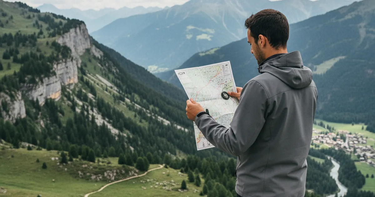
You pack your bag for a mountain hike and slip in an IGN 1:25,000 map. Good move. But can you actually use it once you're out there? Reading a topographic map is a hands-on skill, one you learn gradually and one that can make a real difference when fog closes in, weather turns fast, or the trail simply fades. Across the mountains of Haute-Savoie, the IGN map remains the go-to tool for navigating with confidence.
Contour lines: the heart of the map
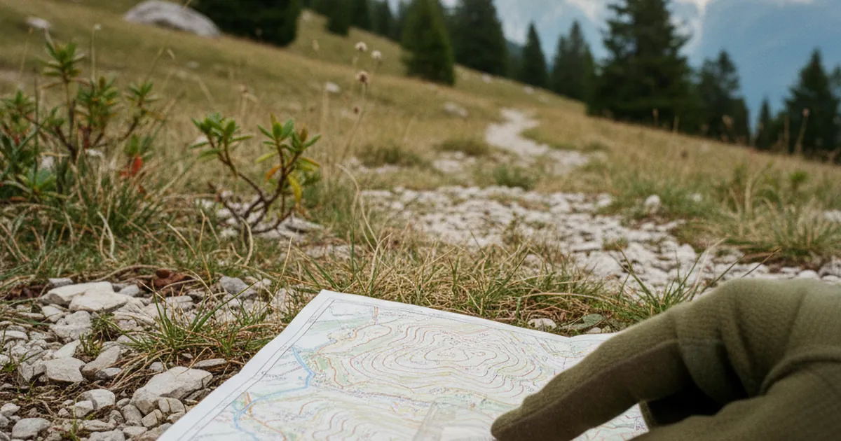
Contour lines are the curved lines that cover the entire map surface. Each one connects points at the same altitude. On IGN 1:25,000 maps, each standard contour represents a ten-metre difference in height. Every fifth line is thicker, called an index contour, and marks a multiple of fifty metres.
What they tell you at a glance:
- Lines packed tightly: the slope is steep, possibly very demanding.
- Widely spaced lines: the terrain is flat or gently rising.
- V-shapes pointing uphill: you are looking at a gully, couloir, or hollow.
- V-shapes pointing downhill: that is a ridge, spur, or nose of ground pushing out.
This reading becomes second nature quickly. Before heading out on La Tournette from Montmin in the Aravis and Bornes range, study the contours around the summit: you will immediately see where the climb steepens, where the flat sections are, and how the final ridge is shaped.
Orienting the map and finding your position
An IGN map has north at the top. To use it in the field, you need to align it with the actual landscape. Two straightforward methods:
By landmark: if you can see a ridge, river, or village in front of you, rotate the map until that feature sits on the correct side. Works well when visibility is clear.
By compass: lay the compass flat on the map, align the direction-of-travel arrow, then rotate map and compass together until the needle points to map north. This works in fog and dense forest.
To pinpoint your exact location, identify two features you can recognise on both the terrain and the map: a distinctive summit, a pass, a stream confluence. Trace two sighting lines mentally. Your position is at their intersection. This is called a cross-bearing, and it is the foundation of terrain navigation.
Key symbols for mountain terrain
The full legend is printed inside the cover of every IGN map. Here are the most useful symbols on alpine routes:
- Footpaths: dashed lines (GR long-distance routes in red, other paths in black or dotted).
- Roads and tracks: shown according to their actual width.
- Watercourses: in blue, torrents as thin lines, larger rivers as thicker ones.
- Staffed mountain huts: solid black triangle. Unstaffed shelters: open triangle.
- Springs: small circled blue dot, invaluable in dry periods.
- Cliffs and rock faces: black hatch marks running perpendicular to contour lines.
- Forest: pale green, with nuances for vegetation type.
Background colour is also a guide: white for open or rocky ground, green for forest, blue for wetlands or glacial areas. In the Giffre valley, the IGN sheets clearly mark the combes and persistent snowfields you will encounter early in the season.
Estimating distances and walking time
At 1:25,000, one centimetre on the map equals two hundred and fifty metres on the ground. A quick trick: a thumbnail is roughly one centimetre, or a quarter of a kilometre at this scale.
One important caveat: distances measured on the map are horizontal. They do not account for elevation gain. For a realistic time estimate, Naismith's rule is a useful starting point: roughly one hour for four kilometres on flat ground, plus one additional hour for every five hundred metres of ascent.
Before you leave, trace your route on the map with a piece of string, then compare its length against the scale bar at the bottom of the map. Combine that with the elevation gain read from the index contours and you have a solid working estimate. On the Col du Reray and Grand Château route, this kind of pre-trip analysis lets you anticipate exposed sections and plan your pace from Taninges.
Paper map and GPS: use both
A GPS app on your phone or a GPS watch is handy for real-time positioning. But it does not replace a map for one fundamental reason: it does not help you understand the terrain. A map forces you to read the whole landscape, anticipate obstacles, and spot possible alternatives.
Dead batteries, signal blackouts, thick fog that leaves you working from whatever you can see in front of you: in Haute-Savoie, these situations are real, and the pronounced relief can create GPS shadow zones in narrow enclosed valleys. Paper map and compass remain irreplaceable.
The best approach is to use both tools together. Find your position on GPS, then transfer it mentally to the paper map to make sense of your surroundings. This habit builds genuine autonomy and prepares you to navigate in any conditions.
Learning to read a 1:25,000 IGN map takes a bit of practice, but it is a skill that stays with you for a lifetime of hiking. Start on routes you know well, practice locating yourself without reaching for your phone, and you will soon find that map-reading becomes a real pleasure. Every day out in the mountains of Haute-Savoie is a new chance to sharpen the skill.