The soil of Haute-Savoie still occasionally gives up surprises: milestones, fragments of paving, place names that betray a Latin origin. Roman presence in these alpine valleys stretched across several centuries, leaving traces you might stumble upon while hiking. There are no grand forums or spectacular aqueducts here, but a geography that was crossed, controlled, and organized by a power that understood that mastering the Alps meant mastering the exchange of goods and people between northern and southern Europe.
An alpine territory integrated into the empire
The area that now makes up Haute-Savoie was home to the Allobroges and several other alpine peoples before the Roman conquest. Around the turn of the first century BCE, Rome progressively incorporated these lands into the province of Alpes Graiae et Poeninae. This administrative division covered a wide arc of mountain territory, stretching from today's Savoie to the Swiss Valais.
The goal was not to densely settle a difficult high-altitude territory, but to control the passes, secure trade routes, and collect tribute. Geneva (Genava) played a central role in this network: from this crossroads city, Roman roads radiated south along the Rhône, east along Lake Geneva, and into the interior alpine valleys.
The main routes: valleys and passes
The Romans built their roads along the most direct and best-drained lines. In terrain as rugged as the Alps, that meant following valley floors or using lower-altitude passes.
The Arve valley is one of the most obvious natural corridors: it offers an unbroken route from the Lake Geneva basin into the high alpine valleys. The towns of Bonneville and Ayse lie along this historic corridor, and sporadic archaeological finds in the region confirm the presence of Romanized populations. From the plain, secondary routes climbed into the transverse valleys: the Giffre valley, the heights of the Chablais, and slopes leading to villages such as Saint-Jean-de-Tholome.
Crossing the alpine passes was a major strategic concern for Rome. The Great Saint Bernard (Mons Poeninus in ancient texts) is the best-documented alpine crossing near our region: it was the route legions and merchants used to reach northern Italy. Lower-altitude passes served as seasonal local connections between the valleys.
What remains today
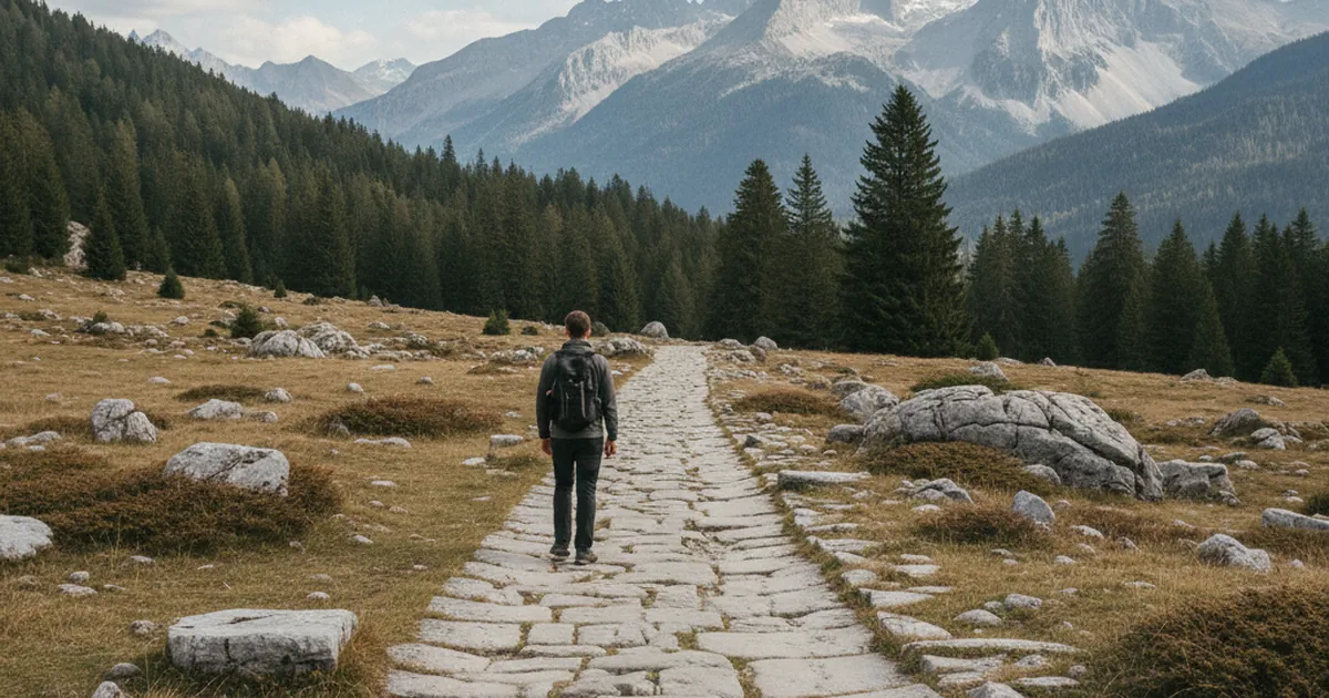
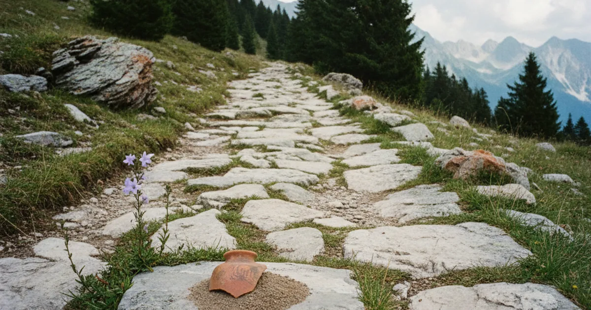
The physical footprint of Roman roads in Haute-Savoie is fragmented. Unlike the great cities of Provence or the Rhône valley, the alpine zone has not preserved long, clearly defined stretches of road surface. Several reasons explain this: repeated flooding, rockfalls, centuries of rebuilding along the same alignments, and the systematic reuse of building materials by later generations.
What does survive are milestones held in regional museums, revealing place names (Latin-derived forms in hamlet and path names), and targeted excavations that yield Roman or Gallo-Roman coins, brooches, and pottery. These objects confirm a lasting presence, even if the alpine territory remained less densely urbanized than the neighboring lowlands.
Hiking these traces
You will not always find a sign reading "Roman road" when you are out in the mountains, and that is precisely what makes exploring these traces interesting. Many current hiking trails follow much older alignments, taken over by medieval populations and later woven into modern paths.
For routes that cross ancient heritage sites, the Giffre valley and its gorges offer particularly evocative terrain. The hike through the ancient gorges of Tines and the mountain takes you through a site whose very name signals that people have been passing through here for a very long time. The gorges form a natural gateway that every era has had to use or find a way around.
The Pas de l'Échelle is another example of these mountain passages whose history extends well beyond our own time. Steps cut into rock to ease the ascent appear on several old alpine routes, evidence of the patient human work involved in making the passes accessible.
Toponymy: the first archive
Before you even lace up your hiking boots, a topographic map can tell you a great deal. Place names are often the most accessible evidence of Roman or Romanized passage. Some IGN maps still mark "Chemin des Romains" (Roman road) along ridgeline or pass routes. These micro-toponyms often survive the centuries better than the paving stones themselves: a path's name can travel through time more reliably than the road surface underneath.
Latinized suffixes, Gaulish roots transformed by Romanization, or simply names that evoke the ancient function of a place (a pass, a watchtower, a relay station): reading the map becomes a small historical investigation in its own right.
The Roman roads of Haute-Savoie are not a spectacle as such. They are a layer of history to be read in the landscape, in place names, and in those unavoidable passages that people have used for two thousand years just as they do today. Next time you go hiking in Haute-Savoie, look at the topographic map and search for those "Chemin des Romains": they might just lead you back two millennia.